Housing corridor
Upper Bucks
Corridor grouping is curated for housing comparison — not a municipal boundary.
East Rockhill Township is one of Bucks County's 54 municipalities. This profile routes tax layers, school district context, corridor framing, and official county records — with honest source labels on every claim.
Overview editorial is still expanding for East Rockhill Township. The facts below come from curated municipal reference data — not market valuations or price claims.
Upper Bucks
Corridor grouping is curated for housing comparison — not a municipal boundary.
18944
ZIP codes do not determine school district assignment in Bucks County.
5,571
Municipal reference data — confirm with U.S. Census for official counts.
22.2 sq mi
Municipal reference data.
40.4383, -75.2711
Centroid-style reference point for GIS orientation — not a property boundary.
Census-cited figures for East Rockhill Township from the American Community Survey 5-Year Estimates (2020–2024). These are survey estimates with margins of error — context for a decision, not a current listing price.
$485K
Owner-occupied units (B25077) · ±$64K margin
$134K
Table B19013 · ±$16K margin
$1,188
Monthly, renter-occupied units (B25064)
85.9%
Of 2,356 occupied households (B25003)
44.1 yrs
Table B01002
37.7 min
One-way, workers 16+ (B08013/B08303)
Source: U.S. Census Bureau — American Community Survey 5-Year Estimates (2020–2024), tables B25077, B19013, B25064, B25003, B01002, B01003, B08013, B08303. Retrieved 2026-07-22.
Curated municipality-to-district mapping — still verify at the property address; some townships span district boundaries.
Pennridge School District schools — the district roster from the federal NCES directory. Assignment within the district is set by the exact address, not the town.
Roster source: NCES EDGE open data — School Characteristics (CCD 2024–2025) and Private School Locations (PSS 2023–2024). Retrieved 2026-07-18.
Bucks County property owners receive separate county, municipal, and school district tax bills. The rates below are transcribed from the county's official millage sheet and apply to a property's county assessed value — a fraction of market value — not its sale price.
Estimate only: assessed value × mills ÷ 1,000 per layer, before the homestead exclusion or any interim adjustments. The county bill is what the offices say it is, not what a website computes.
Source: Bucks County Board of Assessment — 2026 Millage Rates (sheet dated 2/4/2026). Retrieved 2026-07-22. Estimate a bill: assessed value × mills ÷ 1,000 — try the tax calculator, and look up assessed value in the county property search. Millage rates are provided by local taxing authorities. Verify with the Board of Assessment, your municipal tax collector, and your school district before relying on any figure.
Bucks County Board of Assessment — assessment records, appeals, and homestead exemption applications.
Open official source →East Rockhill Township bills separately from the county. Find the municipal tax collector for this township via the county tax-collector directory.
Open official source →School tax follows district assignment for East Rockhill Township. Verify district at the property, then confirm millage with the district and Board of Assessment.
Open official source →Official county index of all 54 boroughs and townships — confirm municipal contacts and permit routing locally.
Open official source →For homestead exclusion and assessment appeals, start with the Board of Assessment. See the tax intelligence hub for the full three-layer explainer.
More land per dollar, lower density, borough anchors like Quakertown and Perkasie, and the most patient appreciation in the county.
Buyer framing (curated): More land per dollar, borough downtowns like Quakertown and Perkasie, and Pennridge or Quakertown schools. Buyers who want space often start here.
Compare nearby: Bedminster Township · Dublin Borough · Durham Township · Haycock Township · Hilltown Township · Milford Township
Assessment, deed, parcel, and municipal contact checks belong in every serious housing decision. These links route to official or curated public-source hubs — not secondary aggregators.
Look up assessed value, parcel ID, and ownership context for properties in Bucks County.
Open resource →Deed chain, recorded documents, and title due diligence.
Open resource →Parcel maps, zoning layers, flood context, and spatial due diligence.
Open resource →Official county index of all 54 boroughs and townships.
Open resource →Production housing intelligence means honest gaps — not filler. These items still need official source input or licensed data before they can be published as facts.
Editorial overview not yet written for this town. Identity facts and official-source routing below are still available.
County + municipal + school
Every Bucks County property has three separate tax bills. Millage rates are not published on this profile — verify with the Board of Assessment and municipal tax office.
Pennridge SD
Curated municipality mapping. District assignment is still address-level — verify before you act.
Upper Bucks
More land per dollar, lower density, borough anchors like Quakertown and Perkasie, and the most patient appreciation in the county.
Expanding
Editorial overview pending. Identity facts below are sourced from municipal reference data.
At $484,700, the median home in East Rockhill Township runs 8.9% above the $445,250 county median — 20th highest of the 54 municipalities with a published figure. Median household income runs 18.5% above the county at $134,492. Owner-occupancy is high at 85.9%, so resale stock turns over slowly and rentals are scarce. The mean one-way commute is 37.7 min against a county median of 28.9 min.
| Measure | East Rockhill Township | County median | Rank |
|---|---|---|---|
| Median home value | $484,700 | $445,250 | 20th of 54 +8.9% |
| Median household income | $134,492 | $113,475 | 17th of 54 +18.5% |
| Median gross rent | $1,188 | $1,575 | 49th of 52 -24.5% |
| Owner-occupied share | 85.9% | 80.7% | 18th of 54 +6.4% |
| Mean commute | 37.7 min | 28.9 min | 3rd of 54 +30.4% |
| Median age | 44.1 | 44.1 | 27th of 54 +0.1% |
| Population density | 251 / sq mi | — | 22.2 sq mi total |
Ranks and county medians are computed across all Bucks County municipalities reporting each measure in the American Community Survey 2020–2024 5-year estimates. Rank 1 is the highest value, not the "best" — a high median home value and a long commute are both rank 1 at the top of their columns.
Closest matches on home value, income, rent, owner-occupancy and commute — the towns a buyer weighing East Rockhill Township usually ends up comparing it against.
Open market residents hire their own hauler. See township page for guidance.
Record verified May 2026 from municipal, county, and hauler sources. County HHW program ↗ · Municipal site ↗
Part of the park's 5,000-plus acres reaches into the township — the lake is a neighbor, not a day trip.
Municipal parks and reservable facilities managed by the township.
East Rockhill sits between Perkasie’s sidewalks and Lake Nockamixon’s shoreline, and that’s the pitch in one sentence: Pennridge schools and borough conveniences five minutes one way, the state park’s water and trails five minutes the other. The township’s own parks fill in the everyday playground-and-pavilion needs.
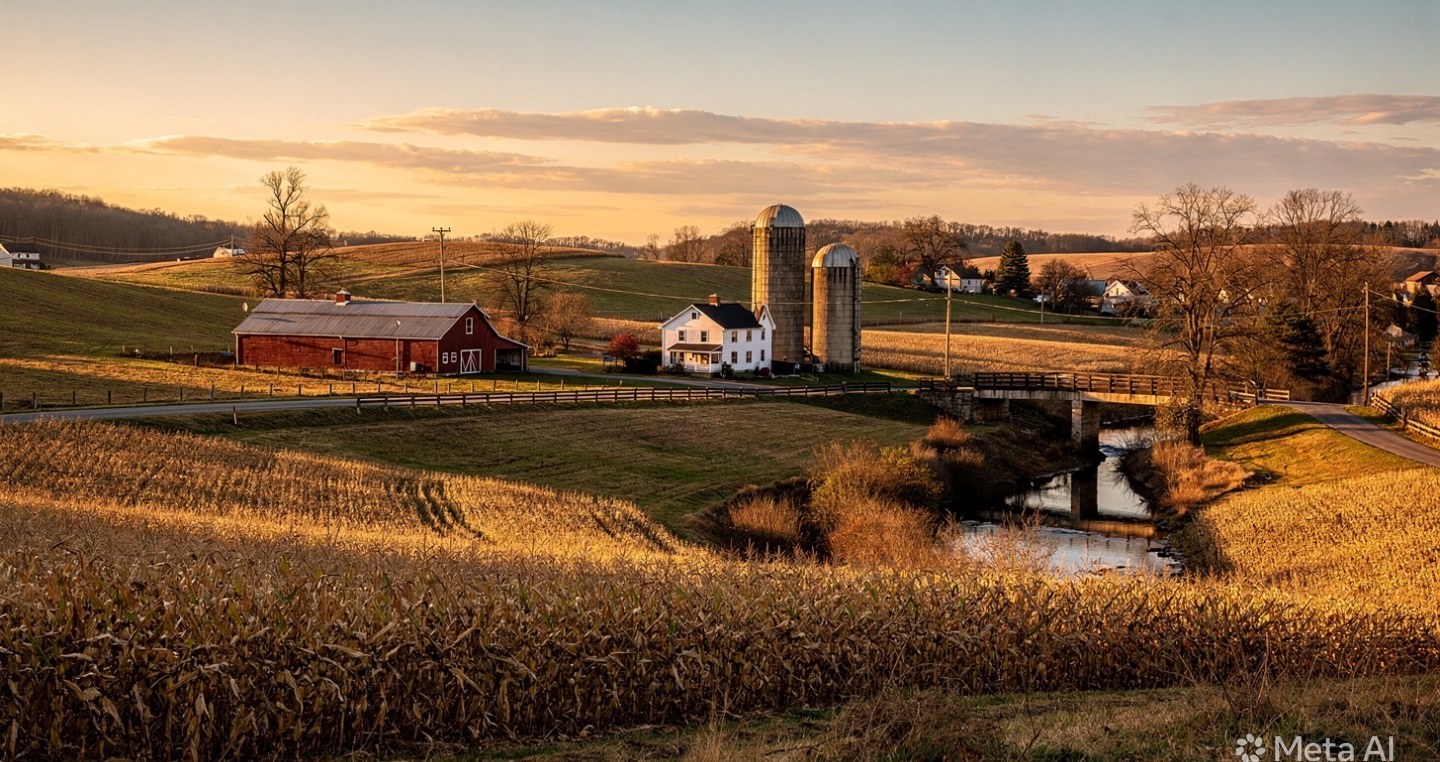
Housing is a mix of older village pockets and newer single-family streets, generally priced a notch below Perkasie proper for comparable space. Like the rest of Upper Bucks, it’s car-country — Route 313 and 563 are the working roads, and the Quakertown Turnpike interchange is the fastest way out of the county.
Last verified July 23, 2026. Sources: DCNR — Nockamixon State Park · East Rockhill Township — Parks & Open Space . Hours, schedules, and access rules change — confirm with the operator before you plan around them.
A East Rockhill Township address is presumed to sit in Pennridge SD, but boundaries split streets — confirm the assignment for the exact parcel. Assessment matters more than the $484,700 median suggests: Bucks County assesses at a fraction of market value, so two similar East Rockhill Township homes can carry very different bills.
East Rockhill Township is served by Pennridge SD. School assignment in Bucks County is address-level — some townships span attendance boundaries — so always confirm the assigned school for a specific property with the district before making an offer.
The median value of owner-occupied homes in East Rockhill Township is about $485K, per the U.S. Census Bureau's American Community Survey 5-Year Estimates (2020–2024, table B25077). ACS figures are survey estimates with a margin of error, not current listing prices — use them for context, not pricing.
East Rockhill Township has a median household income of about $134K, a median age of 44.1, 85.9% owner-occupied households, per ACS 5-Year Estimates (2020–2024). See the market snapshot on this page for the full census-cited profile.
East Rockhill Township property owners pay three separate bills totaling 182.0742 mills on the county assessed value (2026 county sheet): county 29.65 mills, East Rockhill Township 12.235 mills, and Pennridge SD 140.1892 mills. Mills apply to the assessed value — a fraction of market value — so estimate a bill as assessed value × mills ÷ 1,000, and verify rates with the Board of Assessment before closing.
Workers living in East Rockhill Township average about 37.7 minutes each way, per ACS 5-Year Estimates (2020–2024, tables B08013/B08303). East Rockhill Township sits in the Upper Bucks corridor of Bucks County.
East Rockhill Township is a township in the Upper Bucks corridor of Bucks County, Pennsylvania (ZIP 18944). More land per dollar, lower density, borough anchors like Quakertown and Perkasie, and the most patient appreciation in the county.
East Rockhill Township settlements route through the township office for permits, use-and-occupancy and certifications, and through the county for deeds and assessment. When diligence is done and documents need a professional hand, BucksNotary supports loan signing and notarization across Bucks County.
Compare East Rockhill Township against other municipalities in Upper Bucks — then confirm property-level facts through official county records.

Looking to move?
Graham Sullivan is the licensed Pennsylvania Realtor behind BucksCountyHousing.com — buyer and seller representation backed by the same town, tax, and school intelligence you're reading right now. No handoffs, no call centers. Just local expertise.
Looking for help?
Buying, selling, taxes, schools, or a town you can't figure out — send it over. A real local person reads and answers every message.
Make this site better
Photos, local knowledge, corrections, and ideas from residents make every page stronger.
Family favorites